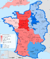
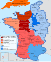
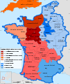
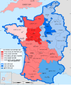
File:France 1154-fr.svg
Appearance
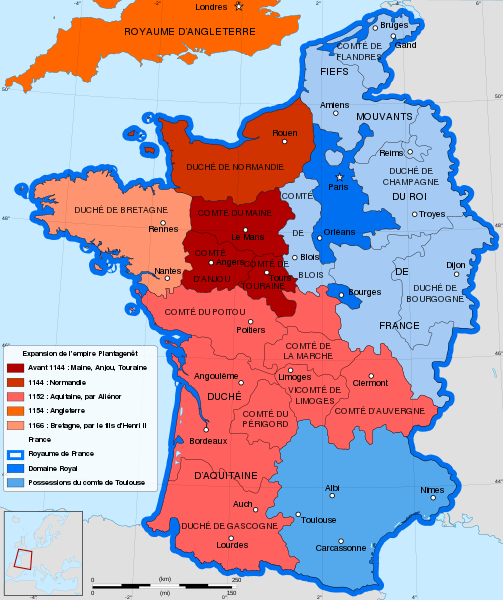
Size of this PNG preview of this SVG file: 503 × 600 pixels. Other resolutions: 201 × 240 pixels | 403 × 480 pixels | 644 × 768 pixels | 859 × 1,024 pixels | 1,718 × 2,048 pixels | 1,405 × 1,675 pixels.
Original file (SVG file, nominally 1,405 × 1,675 pixels, file size: 529 KB)
File history
Click on a date/time to view the file as it appeared at that time.
| Date/Time | Thumbnail | Dimensions | User | Comment | |
|---|---|---|---|---|---|
| current | 14:59, 21 May 2021 |  | 1,405 × 1,675 (529 KB) | YaouhPower | Correction orthographe Angoulême |
| 11:31, 12 July 2013 |  | 1,405 × 1,675 (542 KB) | Citypeek | Corrected two mistakes in code. Valid SVG now. | |
| 08:53, 27 January 2012 |  | 1,405 × 1,675 (542 KB) | Sémhur | Few mistakes in legend | |
| 11:44, 27 July 2009 |  | 1,405 × 1,675 (678 KB) | Sémhur | == {{int:filedesc}} == {{Information |Description= {{en|French map of the growth of the Plantagenet Empire, from 1144 to 1166.}} {{fr|Carte en français de l'expansion de l'empire Plantagenêt, de 1144 à 1166.}} |Source={{own}}. Sources : * [[:Image:Fran |
File usage
The following 3 pages use this file:
Global file usage
The following other wikis use this file:
- Usage on be.wikipedia.org
- Usage on es.wikipedia.org
- Usage on eu.wikipedia.org
- Usage on fr.wikipedia.org
- 1154
- Henri II (roi d'Angleterre)
- Comté de Poitou
- Aliénor d'Aquitaine
- Histoire de l'Aquitaine
- Discussion:Cartographie/Archive01
- Comté de Touraine
- Maison de Laval
- Empire Plantagenêt
- Foulques V d'Anjou
- Duché d'Aquitaine
- Histoire des grandes puissances
- Histoire de l'Anjou
- Comté de Blois
- Discussion:Cartographie
- Discussion:La Rochelle/Archives 1
- Liste des comtesses et duchesses d'Anjou
- Hugues le Brun
- Liste des maîtres de la province d'Auvergne de l'ordre du Temple
- Usage on lt.wikipedia.org
- Usage on pt.wikipedia.org
- Usage on ro.wikipedia.org
- Usage on sk.wikipedia.org
- Usage on sl.wikipedia.org
- Usage on uk.wikipedia.org


